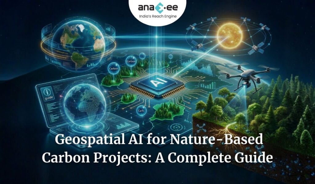
Geospatial Machine Learning: The Engine Behind High-Integrity Nature-Based Carbon Projects
Nature-based carbon projects carry a huge promise. They can protect forests, restore degraded landscapes, support biodiversity, and generate income for local communities. But let’s be blunt: they have also been the center of serious criticism.
Many of the problems are well-known by now:
- Baselines that overestimate risk
- Leakage that is poorly accounted for
- Land unsuitable for the species planted
- Mortality that goes undetected for years
- Claims based on patchy field data
- Slow verification cycles
- And overall, a lack of transparency
In other words, too much of the system has depended on judgment calls, static assumptions, and limited monitoring.
But things are finally changing — not because carbon markets suddenly became disciplined, but because geospatial machine learning (ML) is disrupting how nature-based projects are designed, validated, and monitored.
The companies featured in the IETA Live session — Pachama, Planet Labs, Carbon AI, and others — represent this shift. They are building the analytical engine that the carbon market has always needed but never had: a way to understand landscapes at scale with objective, repeatable, data-driven methods.
This blog breaks down how geospatial ML works in carbon projects, why it is so transformative, what limitations still exist, and how Anaxee fits into this evolving landscape — especially in countries like India, where ground execution matters just as much as remote sensing.
1. What Exactly Is Geospatial ML in Carbon Projects?
Let’s make this simple.
Geospatial machine learning combines:
- Satellite data
- LiDAR data (airborne, spaceborne)
- GIS layers (roads, rivers, elevation, soil, land cover)
- Historical change maps
- Field plot data
- Weather and climate data
- Socio-economic layers
…and uses algorithms to:
- Detect patterns
- Predict land-use behavior
- Build baselines
- Estimate biomass
- Simulate future carbon outcomes
- Identify risk areas
Think of it as a system that studies the behavior of landscapes over space and time.
Traditional project design starts with a narrative:
“Deforestation risk is high because of logging pressure,” or
“This land is suitable for agroforestry.”
Geospatial ML replaces that narrative with evidence-based, pixel-level learning:
- How has similar land behaved over the past 10 years?
- How likely is it that deforestation will increase or decrease?
- What is the probability that leakage appears in nearby zones?
- Which parts of this land are truly suitable for restoration?
- Where is regrowth likely to succeed vs. fail?
With enough data, the models get better, fairer, and more realistic.
That’s exactly what the carbon market needs: fewer assumptions and more measurable patterns.
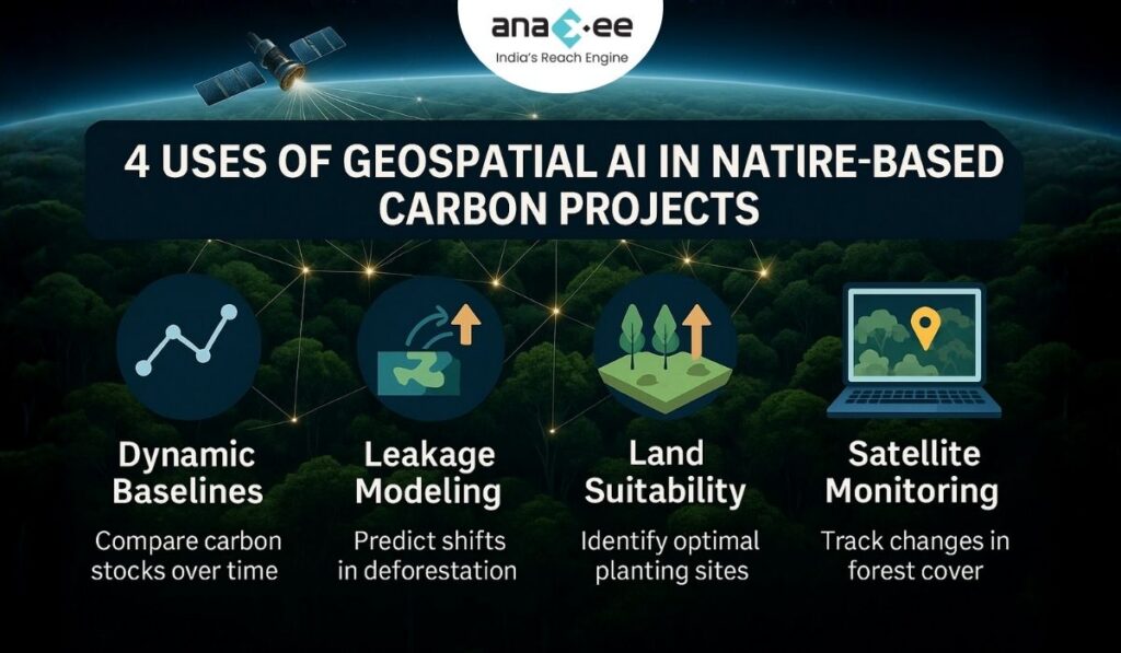
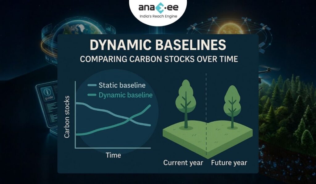
2. Dynamic Baselines: The End of Frozen-Assumption Carbon Accounting
For years, baselines have been the most controversial part of REDD+ and other nature-based methodologies. Many baselines were:
- Set once every 10 years
- Based on thin historical data
- Poorly matched to actual drivers of change
- Too optimistic
- Too slow to update
The dynamic baseline model changes the entire game.
Here’s how Pachama and similar groups build them:
Step 1 — Select an area around the project (often 50–100 km).
This creates a large pool of comparable land.
Step 2 — Identify “control pixels” that match the project area’s attributes:
- Elevation
- Slope
- Rainfall
- Soil
- Forest type
- Proximity to roads, rivers, towns
- Past land-use change
These are not arbitrary choices. The model statistically finds the most relevant matches.
Step 3 — Track how those matched pixels actually changed over time.
If similar pixels are losing forest at 2.5% annually, the model uses that trajectory as the baseline risk.
Step 4 — Update as conditions shift.
New roads, new agricultural trends, political changes, new satellite observations — all of these feed into updated predictions.
Dynamic baselines solve several long-standing problems:
- They reflect real pressures, not narratives.
- They adjust over time, avoiding stale assumptions.
- They reduce inflation risk, because they are tied to observed patterns.
- They match global expectations for transparency from buyers and media.
We’re finally moving from:
“…we think this forest was at risk”
to
“…here’s the measured behavior of comparable forest under similar conditions.”
This is a huge win for integrity.
3. Leakage Modeling: Quantifying What Has Always Been Hand-Waved
Leakage is simple to understand:
If you protect one area, pressure moves to another area.
But historically, leakage accounting has been messy:
- Vague discount factors
- Minimal behavioral modelling
- Ignoring economic drivers
- Limited spatial analysis
- Flat assumptions across large landscapes
Geospatial ML brings order to the chaos.
Models now consider:
- Economic value of land
- Agricultural expansion patterns
- Road accessibility
- Market proximity
- Historical displacement patterns
- Demographic and livelihood pressures
For example:
If a REDD+ project stops timber extraction, the model studies nearby forests with similar characteristics to see where extraction tends to shift. It can then predict leakage probability and intensity, generating a data-backed leakage deduction.
This turns leakage from an “integrity risk nobody wants to talk about” into a quantifiable component of carbon accounting.
The carbon market desperately needs this. Without realistic leakage modeling, baselines are half-truths.
Geospatial ML finally gives us the tools to confront leakage honestly.
4. Land Suitability: Planting the Right Trees in the Right Place
Afforestation and agroforestry projects often struggle because the land they choose is simply not ready — or not appropriate — for the planned activity.
Typical errors include:
- Planting species unsuited to soil conditions
- Choosing slopes prone to erosion
- Selecting land that already has competing claims
- Underestimating drought/flood risks
- Choosing plots with poor accessibility for maintenance
Geospatial ML tools now evaluate suitability using:
- Soil type
- Moisture and drainage patterns
- Historic vegetation signals
- Rainfall and temperature profiles
- Likely climate shifts
- Current land-use patterns
- Accessibility
- Slope and terrain ruggedness
- Proximity to settlements
Instead of generic feasibility reports, developers get confidence maps:
- High suitability
- Moderate suitability
- Low suitability
- High risk
This saves money, reduces mortality, improves survival rates, and ensures projects produce real carbon — not just planting-day photographs.
For buyers, this kind of rigor builds confidence in long-term sequestration.
5. Monitoring: From “Every Few Years” to “Every Season”
This is where geospatial ML becomes most visible.
Traditional monitoring cycles are slow:
- A verifier visits every 2–5 years
- Satellite imagery is used only sparingly
- Growth models rely on annual or decadal assumptions
- Degradation often goes unnoticed
- Encroachment is detected too late
Now, with 3-meter Planet imagery and ML-driven analysis, developers can:
- Detect canopy loss in a specific corner of the project
- Spot small encroachments before they escalate
- Track regrowth block by block
- Compare biomass changes over seasons
- Flag anomalies linked to fire, pests, or storms
- Identify zones with stress or die-off
This turns monitoring from a passive, backward-looking process into an active management tool.
Imagine being able to:
- Send a field team to intervene within weeks, not years
- Update investors on performance quarterly
- Catch early degradation trends
- Adjust management practices dynamically
That’s the future — and it’s already happening in high-quality projects.
6. A Reality Check: What Geospatial ML Still Cannot Do
Despite the hype, geospatial ML is not magic.
Here’s what it cannot reliably replace:
Human judgment about land ownership and consent
No satellite can tell you if a farmer wants the trees you’re proposing.
On-ground species verification
Remote sensing cannot fully differentiate species in mixed agroforestry systems.
Actual planting quality
You still need humans to check pit size, spacing, planting technique, and maintenance.
Survival counting in early years
When trees are small or hidden under grass, only trained field teams can confirm survival.
Community dynamics
Social acceptance, benefit-sharing, local politics — these are invisible from space.
Context behind anomalies
Satellites may show canopy loss, but they can’t tell whether it was:
- grazing,
- firewood collection,
- drought stress,
- fungal disease,
- or a farmer simply removing a failing species.
This is why hybrid MRV — geospatial ML + field truth — is the only credible path forward.
Anyone claiming satellites alone can replace human monitoring is selling a fantasy.
7. The Hybrid Future: Satellites for Scale, Humans for Ground Truth
The strongest nature-based projects will use a layered approach:
Layer 1 — Satellites
High frequency, global coverage, objective patterns.
Layer 2 — Geospatial ML
Interpretation, prediction, baseline building, and risk mapping.
Layer 3 — Field Teams
Verification, community engagement, species confirmation, survival counts, qualitative insights.
Together, this creates a system that is:
- More reliable
- More transparent
- Cheaper to verify
- Harder to manipulate
- More attractive to buyers
This is the operating model carbon markets must move toward if they want to regain trust.
8. So Where Does Anaxee Fit Into This Shift?
This is where most discussions miss the plot.
Everyone talks about satellites and AI, but:
No AI can replace the need for scalable, reliable, on-ground execution.
And no remote sensing dataset is complete without consistent field truth.
Anaxee solves exactly these two problems.
(A) India’s Largest Ground Workforce for Climate Projects
Anaxee’s Digital Runner network is the missing infrastructure that global tech platforms lack.
They provide:
- Plot-level GPS mapping
- Baseline field surveys
- Consent documentation
- Species verification
- Photographic evidence of planting
- Survival counts over time
- Activity logs of maintenance
- Farmer interactions and benefit-sharing records
This is the dataset that geospatial ML models desperately need but cannot generate on their own.
(B) AI-Ready dMRV: Structuring the Field Data
Most field data in carbon projects is messy:
Unstructured images, PDF reports, notes on WhatsApp.
Anaxee fixes this by using an end-to-end digital MRV stack that ensures:
- Geo-tagged images
- Time-stamped activity logs
- Structured species and plot information
- Farmer-linked records
- Clean, exportable datasets
- Traceable evidence trails
This makes it possible for AI systems — from Pachama, Planet, or Carbon AI — to plug in ground truth directly.
AI needs good data.
Anaxee produces it at scale.
(C) Closing the Loop: Ground-Truthing Satellite Signals
If satellite data flags a canopy drop in a particular patch, Anaxee’s field teams can:
- Visit the site rapidly
- Determine the cause
- Document the condition with photos and videos
- Suggest corrective actions
- Verify regrowth later
No satellite can provide this level of context.
This human-in-the-loop structure is what ensures that geospatial ML insights lead to real-world action.
(D) Ensuring Community Buy-In and Long-Term Sustainability
Geospatial ML can tell you where a forest could survive.
But only people on the ground can ensure it will survive.
Anaxee teams handle:
- Farmer onboarding
- Community engagement
- Training
- Incentive distribution
- Ongoing support
- Monitoring of grievances
This turns planting into long-term carbon outcomes — not short-lived greenwashing exercises.
9. Final Takeaway: Geospatial ML Brings the Intelligence. Anaxee Brings the Reality.
Nature-based carbon projects have always struggled with credibility.
Geospatial ML gives us the analytical backbone we need — dynamic baselines, leakage modeling, forest monitoring, land suitability, and long-term performance tracking.
But without reliable, scalable, structured field data — the satellite-AI stack becomes incomplete.
That’s why Anaxee’s role is so critical.
Geospatial ML tells us what the land is doing.
Anaxee makes sure the land does what the project claims.
Together, this hybrid model is what will define high-integrity nature-based carbon projects in the next decade.
The industry is finally maturing — and integrity will be built from both above (satellites) and below (people on the ground).
About Anaxee:
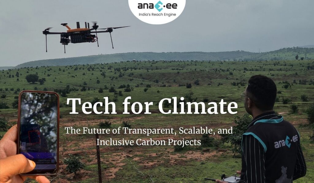
Anaxee is building the Climate infrastructure platform that helps Carbon Project developers and Climate investors maintain continuity of their project over its lifetime. From field data to verified credits. They believe the future of carbon projects lies in trust, transparency, and technology working together.
Anaxee Digital Runners helps in implementation of large-scale, country-wide, climate and Carbon Credit projects across India. Anaxee focuses on Nature-Based Solutions (NbS) and community-driven interventions, including agroforestry, regenerative agriculture, improved cookstoves, solar devices, and clean water systems.
Anaxee’s “Tech for Climate” infrastructure integrates a tech-enabled, feet-on-street network with digital MRV (Measurement, Reporting, and Verification) systems to ensure transparency and real-time validation for every carbon project. By combining data intelligence with local execution, Anaxee enables corporates, investors, and verifiers to trust the integrity, additionality, and traceability of each carbon credit. This approach bridges the gap between communities and global carbon markets, advancing scalable and verifiable climate action across India.