Digital MRV and AI: The Future of High-Integrity Carbon Projects Digital MRV + AI: Fixing the Most Broken Part of Carbon Projects
Carbon markets don’t fail because people plant the wrong trees or design the wrong methodology.
They fail because MRV fails.
Monitoring, Reporting, and Verification — the backbone of carbon crediting — has historically been:
- slow
- manual
- inconsistent
- expensive
- prone to bias
- and easy to manipulate
It is not an exaggeration to say that MRV is the weakest link in the carbon project life cycle.
And here’s the uncomfortable truth:
Even great carbon projects struggle because MRV cannot keep pace with reality on the ground.
But this is changing fast.
A new wave of AI-powered digital MRV systems is emerging — and they are rewriting the rules of how carbon is measured, verified, and valued.
This blog breaks down:
- Why traditional MRV doesn’t work
- What digital MRV actually means
- How AI upgrades every step of measurement
- The gap between satellite MRV and field truth
- What the future of automated verification looks like
- How Anaxee solves the biggest missing piece: primary data integrity
Let’s get into it.
1. The Problem: MRV Has Always Been the Carbon Market’s Bottleneck
The industry rarely says this publicly, but insiders all know:
“MRV is where most carbon projects lose credibility.”
Traditional MRV suffers from several chronic issues.
(1) Infrequent monitoring (every 2–5 years)
Forests change every season.
Crop systems change every month.
Communities change every week.
Yet audits show up once every 3–5 years.
That’s like measuring your bank balance every 5 years and hoping nothing goes wrong.
(2) Small sample sizes
Field surveys may measure 0.01%–0.05% of a forest, then extrapolate for thousands of hectares.
If a few plots are wrong, the entire project is wrong.
(3) Manual processes = human error
Measuring DBH, identifying species, mapping plots, recording GPS manually —
All this depends on skill and discipline.
But field teams vary. Seasonality varies. Execution varies.
And MRV quality varies with them.
(4) High cost
Large-scale MRV campaigns cost tens of lakhs to crores.
Many small projects never reach verification because they simply cannot afford it.
(5) Static assumptions
Projects rely on fixed baselines, fixed growth curves, fixed expansion rates —
Even though forests and farms don’t follow static behavior.
(6) Paper-based evidence
PDF reports, photos on WhatsApp, unstructured metadata —
Impossible to audit properly. Easy to manipulate.
It’s no wonder buyers have started distrusting project claims.
They want proof — not assumptions.
Digital MRV exists to fix precisely these problems.
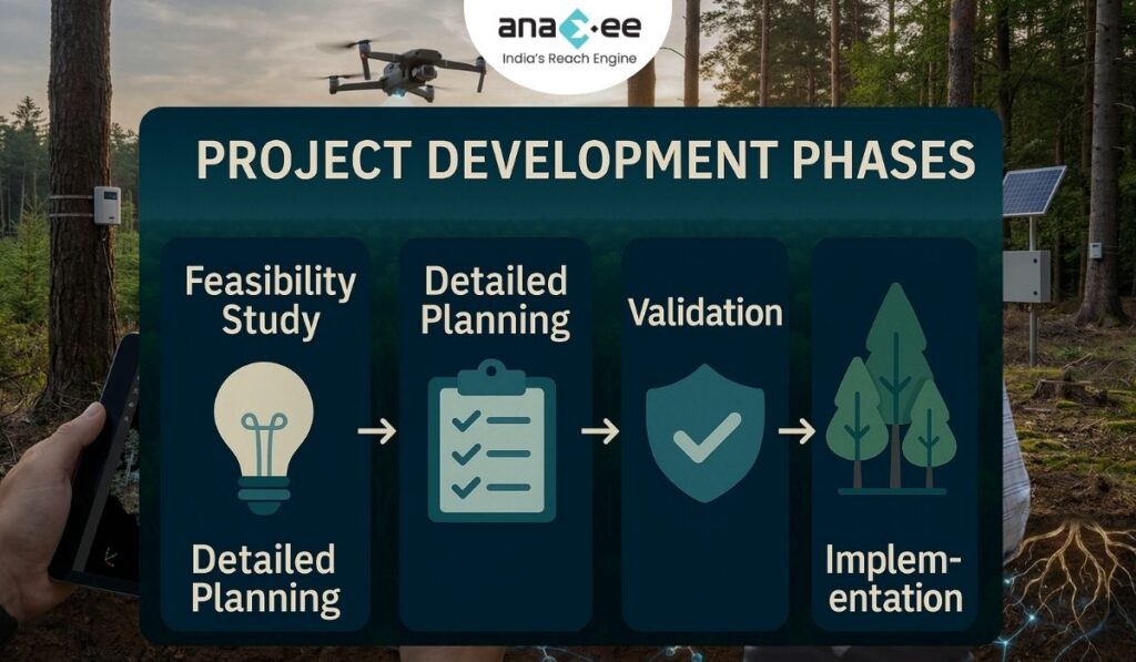
2. What Digital MRV Really Means (And What It Doesn’t)
Digital MRV is not just “collecting data on an app.”
It is a full intelligence system that integrates:
- Satellite data
- Field measurements
- Sensors (where available)
- Machine learning models
- Automated reporting
- API-driven verification flows
A real digital MRV system does four things reliably:
1. Capture the truth
Structured, geo-tagged, time-stamped data — continuously.
2. Make the truth usable
Turn messy field evidence + satellite layers into clean datasets aligned with methodology rules.
3. Monitor change dynamically
Detect anomalies, degradation, mortality, leakage, and performance drops.
4. Output verification-friendly data
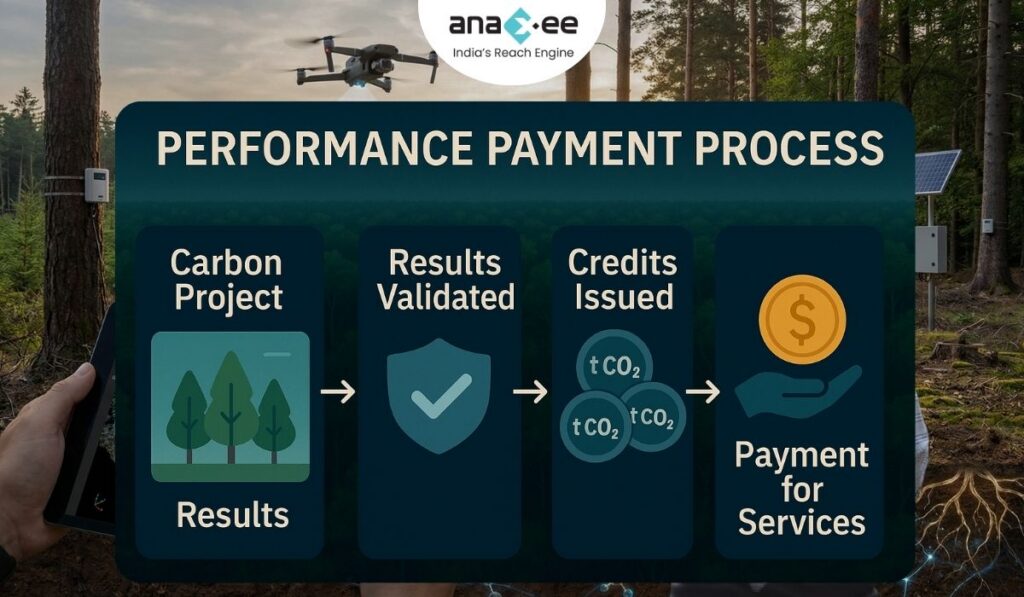
Produce audit-ready datasets with traceability from source to credit.
Digital MRV reduces manual work, increases consistency, and shrinks verification cycles from years to months.
But digital MRV without AI would still be slow.
AI is what makes the system scalable.
3. How AI Is Transforming Every Layer of MRV
AI improves MRV not by replacing humans, but by eliminating the worst parts of manual work.
Here’s how.
(A) AI for Data Cleaning & Validation
Field data is messy.
People forget to click photos, GPS freezes, species names get misspelled, timestamps disappear, plots overlap.
AI solves this by:
- Detecting GPS anomalies
- Flagging incomplete surveys
- Cross-checking species names
- Matching photos to specific plots
- Identifying duplicates
- Validating planting density vs expected numbers
Instead of humans checking 100,000+ data points, AI does it instantly.
Quality jumps.
Errors drop.
Audits become simpler.
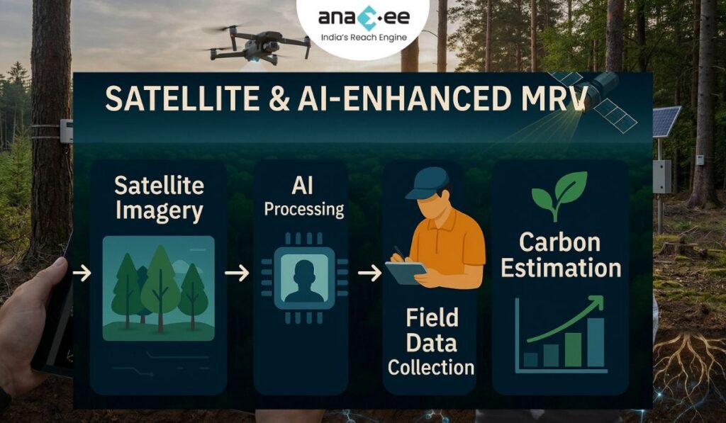
(B) AI for Biomass Estimation
AI combines:
- Satellite imagery
- LiDAR where available
- Vegetation indices
- Growth models
- Past performance history
…to estimate biomass growth far more accurately than static equations.
Traditional models assume linear growth.
AI learns actual growth curves — by forest type, species mix, soil, rainfall, elevation.
This reduces over-crediting risk massively.
(C) AI for Survival Rate Analysis
Detecting survival through field visits alone is inefficient.
AI models can:
- Compare multi-date imagery
- Identify canopy-level change
- Spot gaps in plantation blocks
- Predict early-stage mortality risk
- Flag anomalies requiring field validation
AI doesn’t eliminate field surveys —
It focuses them where they matter most.
(D) AI for Leakage Detection
Instead of manual leakage assumptions, AI:
- Analyzes land-use change in buffer zones
- Tracks agricultural expansion
- Monitors selective logging footprints
- Predicts displacement risk
- Quantifies leakage impact
This produces leakage deductions grounded in evidence — not guesswork.
(E) AI for Activity Verification (Cookstoves, Biochar, etc.)
AI interprets:
- IoT sensor data
- Usage signals
- Heat signatures
- Transaction footprints
- Mobile activity logs
This ensures the carbon claims are tied to real behavior, not self-reported use.
(F) AI for Automated Reporting
MRV reports are repetitive and tedious.
AI can:
- Extract data from raw inputs
- Populate verification templates
- Generate summary tables
- Prepare time-series graphs
- Produce geospatial overlays
- Write narrative summaries
Verification time drops from 6–9 months to 4–8 weeks.
This is transformational for scaling carbon supply.
4. The Limits of AI-Only MRV
Let’s address the hype.
Many people imagine fully automated, satellite-only MRV.
That vision is clean. But it’s unrealistic.
AI + Satellites cannot capture:
- Species-level accuracy
- Exact spacing at planting
- Soil preparation quality
- Early-stage survival
- Maintenance activities
- Community participation
- Social impact
- Land ownership
- Governance risk
- On-ground disturbances below canopy
And AI models are only as good as:
- the quality of field data
- the frequency of data
- the honesty of the supply chain
- the consistency of monitoring
- the structuring of inputs
This is why AI will never replace ground teams.
AI systems require ground truth
— and that ground truth must come from trained, reliable, large-scale human networks.
This is where the industry usually breaks.
Except in India, where Anaxee solves the execution gap.
5. The Future of Verification: Automated, Real-Time, and Continuous
We’re moving toward a world where MRV is:
Continuous, not episodic
Updates every month or quarter — not every few years.
Objective, not narrative-driven
AI-derived baselines, leakage maps, biomass changes.
Transparent and auditable
Every data point has a traceable source ID.
Low-cost and high-frequency
Lower MRV costs = more viable smallholder projects.
Risk-dynamic
AI predicts fires, drought, disease, encroachment.
Instantly verifiable
VVBs audit structured datasets, not raw documents.
But none of this is possible unless primary data collection is high-quality, consistent, and repeatable.
And that’s the piece most tech companies cannot provide.
Which brings us to Anaxee.
6. How Anaxee Completes the Digital MRV + AI Stack
Most AI companies today focus on satellite analytics, modeling, dashboards, or baseline prediction.
What they lack is last-mile execution — the human network required to create continuous, trustworthy ground data.
Anaxee fills exactly this gap.
(A) India’s Largest On-Ground Digital Runner Network
Anaxee deploys trained field workers across:
- remote villages
- forest-edge communities
- smallholder farms
- tribal regions
They collect:
- geo-tagged planting evidence
- survival counts
- species identification
- maintenance activity logs
- land consent documentation
- risk signals
- farmer inputs
No satellite can replace this.
AI needs “ground truth” — and Anaxee supplies it at scale.
(B) dMRV System Built for AI Integration
Anaxee’s digital MRV platform ensures:
- Clean, structured data
- Standardized forms
- GPS-locked images
- Timestamped evidence
- Blockchain-ready traceability
- Real-time dashboards
- API compatibility with AI platforms
AI models from Pachama, Planet Labs, Carbon AI, or others can directly ingest Anaxee’s datasets.
This creates a hybrid MRV system:
Satellite AI → predicts
Anaxee → verifies
AI → updates models
Anaxee → monitors continuously
This loop is the future of carbon verification.
(C) Ability to Operate at Smallholder Scale
Most AI platforms work well for 5,000–50,000 hectare REDD+ projects,
But struggle with:
- 1–3 acre farmers
- multi-species agroforestry
- scattered plots
- varying site preparation quality
- human behavior-driven variability
Anaxee has mastered the operational layer of distributed smallholder ecosystems.
This is where the future growth of carbon markets lies — and where MRV is hardest.
With AI + Anaxee, even 1,000 small farms can be monitored reliably.
(D) Human Oversight in an AI-Driven Market
Anaxee provides what no AI can:
- trust
- context
- social understanding
- cultural nuance
- local problem-solving
AI detects a risk.
Anaxee verifies the cause.
AI predicts solutions.
Anaxee implements them.
That’s how high-integrity carbon outcomes are produced — not by algorithms alone.
7. Final Thought: AI is the Brain. Anaxee is the Hands and Eyes.
Digital MRV is the future —
but AI alone cannot deliver carbon integrity.
For AI to be reliable, its inputs must be clean, consistent, authentic, and ground-truthed.
That’s what Anaxee provides better than anyone else in India.
AI makes MRV scalable.
Anaxee makes MRV believable.
And in a market struggling with trust,
believability is everything.