For years, forest carbon projects have depended on slow verification cycles, scattered field measurements, and trust-based reporting. Everyone in the sector has known the limitations:
- Baselines that rely on outdated assumptions
- Monitoring that happens once every few years
- Subjective interpretation of land use
- Patchy field data with inconsistent quality
- Weak visibility into degradation, regrowth or risk
Meanwhile, corporate buyers and investors expect something entirely different — something closer to real-time visibility and high-resolution transparency, the kind they’re used to in other industries.
That’s exactly why satellite monitoring and AI-driven geospatial analysis are transforming how forest carbon projects are designed, tracked, and evaluated. This shift is not theoretical anymore. It’s already happening.
Companies like Planet Labs, Pachama, Carbon AI, and others from the IETA panel have taken what used to be fuzzy concepts and turned them into credible, usable tools.
This blog explores how this new ecosystem works, why it matters, what limitations still exist, and where a company like Anaxee fits into this evolving landscape.
1. A Daily Image of Earth Changes the Rules Completely
Planet Labs now images the entire Earth every single day.
That statement sounds simple, but its implications for forest carbon projects are massive.
If you’re running or evaluating a REDD+, ARR, IFM, or agroforestry project, this means:
- The land is no longer a “black box” between audits.
- Trends in canopy growth or loss can be measured objectively.
- Selective logging and degradation become detectable.
- Regrowth patterns after interventions are visible.
- Fraud becomes much harder to hide.
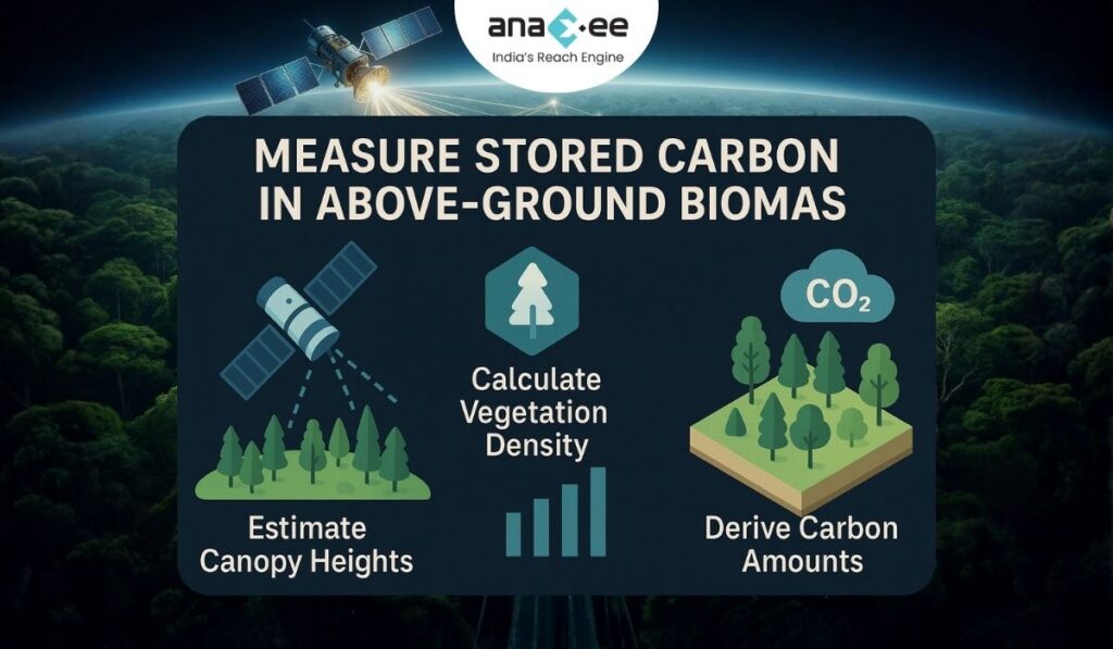
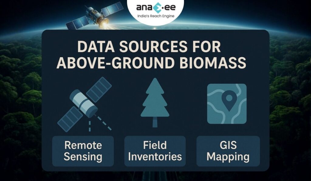
Planet’s system outputs:
- Canopy cover
- Canopy height
- Above-ground carbon estimates (AGC)
…and these aren’t generic, low-resolution products.
The 3-metre forest monitoring product, updated quarterly, can pick up fine-scale changes — the kind project developers typically argue about in verification meetings.
The 30-metre diligence dataset, updated annually with an archive from 2013, provides broader context for baseline, jurisdictional work, and historical trend analysis.
Together, they create something the carbon market has never truly had before: a consistent global dataset of forest structure and carbon stock, refreshed regularly.

2. Goodbye “Plot Sampling Bias,” Hello Wall-to-Wall Transparency
Traditional forest inventories rely on:
- A stratification plan
- Limited field plots
- Extrapolation from small samples to large areas
- Manual measurements with high variability
This approach can absolutely work, but let’s be honest:
It often becomes an exercise in where field teams did or didn’t walk.
Selective sampling, mislocated plots, poor measurement technique, and subjective decisions on stratification have all contributed to over-crediting events in the past.
Satellite-AI monitoring changes the model.
Instead of sampling some of the forest, you can:
- See all of it.
- Map canopy height and carbon across the entire polygon.
- Track changes pixel by pixel, not just plot by plot.
Suddenly, arguments like “most of the forest is intact” or “degradation didn’t matter much” become testable claims rather than narratives.
Plot-based fieldwork doesn’t disappear — but it becomes a calibration tool rather than the primary evidence.
3. Designing Stronger Forest Carbon Projects from Day Zero
Forest carbon projects often fail not during implementation but during design:
- Weak baseline logic
- Poor understanding of local pressures
- Misjudgment of forest condition
- Wrong site selection for restoration projects
- Unrealistic expectations about carbon growth
Satellite-AI data fundamentally improves this.
a) Smarter Feasibility & Site Assessment
Before a project is even registered, developers can now:
- Evaluate historical forest cover change across a decade
- Identify areas with high deforestation pressure
- Analyse forest structure (height/biomass) from day one
- Spot regions with repeated disturbance cycles
- Assess local regrowth potential
This reduces the risk of building projects on shaky assumptions.
b) Baselines Become Evidence-Based, Not Opinion-Based
The biggest controversies in REDD+ projects have centered around baselines that were:
- Too optimistic
- Poorly justified
- Based on thin datasets
- Not reflective of land-use pressure
With Planet’s long-term carbon and canopy datasets, developers get a more grounded view:
- What is the actual recent deforestation trajectory?
- Which landscapes show similar characteristics?
- How has forest structure changed historically?
This pushes baselines toward data-driven realism, reducing the risk of inflated crediting.
c) Credible Additionality
Buyers increasingly want to know:
“Would this forest still be there without the project?”
With satellite archives, developers can demonstrate:
- Acceleration of forest loss before intervention
- Leakage patterns in nearby landscapes
- How similar forests behave under similar pressures
This moves additionality from argument to evidence.
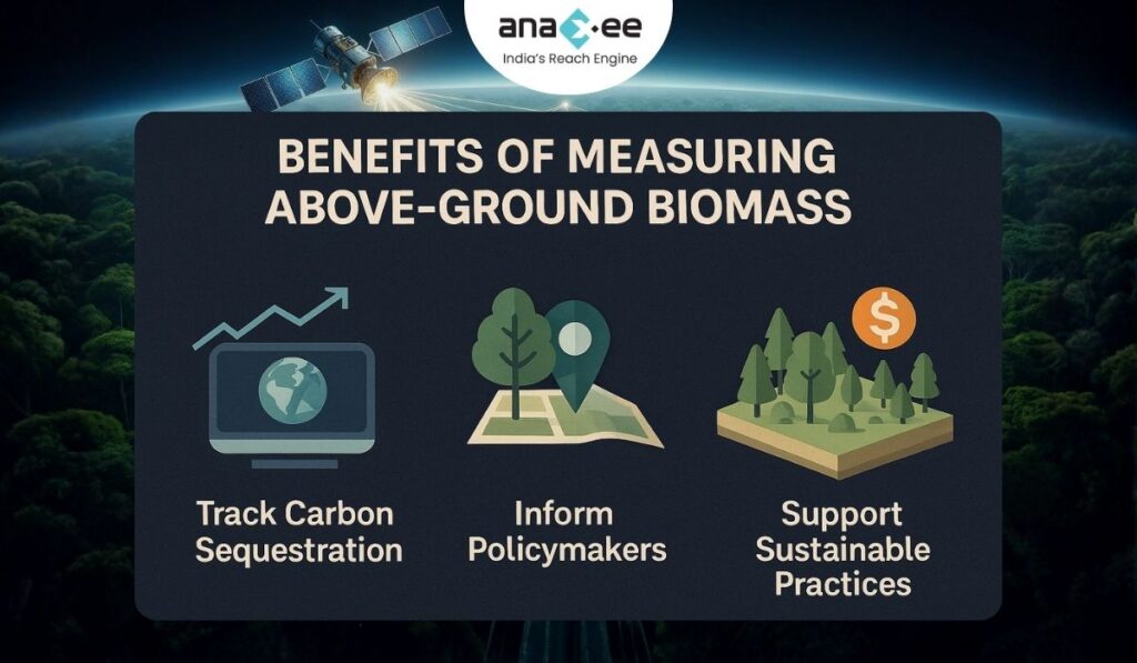
4. Monitoring Degradation — the Hidden Carbon Loss We’ve Ignored for Years
Most global deforestation maps track complete loss, not partial degradation.
But degradation — selective logging, fuelwood extraction, thinning of crown layers — is often the real story behind carbon loss.
3-metre quarterly monitoring captures:
- Gaps in canopy structure
- Reduction in height in specific sections
- Small clearings or encroachment paths
- Selective removal of high-value trees
- Damage from storms, pests, or fire
This type of change wasn’t visible in coarse public datasets.
For REDD+, IFM, or community forestry projects, this is a game changer.
It turns degradation into a measurable, reportable quantity rather than an invisible threat.
5. ARR & Agroforestry Projects: Tracking What Actually Grows
For ARR (Afforestation, Reforestation, Revegetation) and agroforestry projects, the best story isn’t “we planted trees” — it’s:
“Our trees are actually growing, surviving, and storing carbon.”
Satellite-AI tools provide:
- Height growth over time
- Expansion of canopy cover
- Mortality detection
- Evaluation of block-by-block performance
- Detection of patchy plantations or failed areas
Developers can finally:
- React faster to mortality events
- Target gap filling more intelligently
- Report growth trajectories credibly
- Communicate real impact to investors and standards
Most importantly:
It becomes clear which interventions work and which ones don’t.
6. What Satellites Still Cannot Do (and Why It Matters)
Despite the hype, there are several things satellites and AI cannot reliably detect yet:
- Exact tree species
- Precise plantation spacing
- Quality of pit digging and planting technique
- Farmer consent and participation
- Below-ground carbon measurement
- Social or governance risks
- Proper survival counts in multi-species plots
- Damage hidden below canopy closures
Cloud cover also remains a challenge in parts of the tropics.
In other words, satellites are a powerful tool — but only one part of the monitoring system.
They are excellent at detecting patterns and change, not at capturing intent, context, management quality, or socio-economic reality.
Which is exactly why on-ground verification still matters.
7. Integrating Satellite Data With Human Reality: The Hybrid Approach
The next generation of high-integrity forest carbon projects will rely on a hybrid stack:
Satellites
Independent visibility → detects structural change
AI/Geospatial ML
Interpretation → finds patterns, builds baselines
Field Teams
Ground truth → confirms species, survival, social context, land-use conditions
None of these layers can replace the others.
Together, they create a monitoring ecosystem that is:
- Transparent
- Objective
- Adaptive
- Defensible
- Attractive to buyers
This is the system buyers want.
And increasingly, this is the system methodologies will require.
8. So Where Does Anaxee Fit in This New World?
Anaxee is not a satellite company.
We’re not building AI models for canopy prediction.
We operate at a different — and absolutely critical — layer:
We produce the field truth that validates satellite-AI systems and ensures they reflect what’s actually happening on the ground.
Let’s break down how this works.
a) India’s Largest Field Execution Network in Climate Projects
Anaxee’s Digital Runners work across villages, farms, and forest-edge communities.
They provide:
- GPS-based plantation mapping
- Species verification
- Farmer onboarding and consent
- On-ground survival counts
- Activity reporting (watering, weeding, fencing, etc.)
- Evidence collection for audits
- Continuous field observations
This is the kind of primary data that no satellite can replace.
b) Our dMRV Platform Makes Data AI-Ready
We don’t just collect data — we structure it.
Anaxee ensures:
- Time-stamped evidence
- Geo-tagged multimedia
- Standardised survey formats
- On-ground measurements aligned with methodology requirements
- Clean datasets ready to integrate with remote sensing
When satellite-AI tools try to detect patterns, they need reliable ground anchors.
That’s exactly what Anaxee provides.
c) Cross-Verifying Satellite Signals With Field Truth
If Planet shows canopy decline in a patch, Anaxee’s team can:
- Visit the site
- Confirm cause
- Document evidence
- Support mitigation (if needed)
- Feed real intel back into the monitoring system
This allows developers to respond quickly — something traditional MRV cycles cannot support.
d) Social and Implementation Reality — The Missing Ingredient in Tech-Driven MRV
Satellite companies cannot:
- Negotiate with farmers
- Train communities
- Ensure survival through maintenance
- Fix site-level issues
- Facilitate benefit-sharing
- Resolve land disputes
Without this human layer, even the best AI-backed MRV will fail.
Anaxee’s implementation strength ensures that the carbon story is built on:
- Actual community adoption
- Real survival and growth
- Verified interventions
Not just remote sensing estimates.
9. The Bottom Line: Tech and Ground Execution Must Work Together
Satellite monitoring gives the carbon market something it desperately needed:
- Visibility
- Frequency
- Objectivity
- Transparency
Geospatial AI adds:
- Interpretation
- Predictive power
- Risk insights
But neither can replace structured field data and strong, consistent execution.
That’s where Anaxee becomes the anchor point in India’s carbon market ecosystem.
We make high-integrity carbon projects “real.”
Satellite-AI systems then make them “visible.”
Together, they push the entire industry toward:
- Higher transparency
- Lower verification costs
- Better investor confidence
- Faster scaling of nature-based climate solutions
This is not just “MRV improvement.”
It is the beginning of a new operating standard for forest and agroforestry carbon projects.
About Anaxee:
Anaxee is building the Climate infrastructure platform that helps Carbon Project developers and Climate investors maintain continuity of their project over its lifetime. From field data to verified credits. They believe the future of carbon projects lies in trust, transparency, and technology working together.
Anaxee Digital Runners helps in implementation of large-scale, country-wide, climate and Carbon Credit projects across India. Anaxee focuses on Nature-Based Solutions (NbS) and community-driven interventions, including agroforestry, regenerative agriculture, improved cookstoves, solar devices, and clean water systems.
Anaxee’s “Tech for Climate” infrastructure integrates a tech-enabled, feet-on-street network with digital MRV (Measurement, Reporting, and Verification) systems to ensure transparency and real-time validation for every carbon project. By combining data intelligence with local execution, Anaxee enables corporates, investors, and verifiers to trust the integrity, additionality, and traceability of each carbon credit. This approach bridges the gap between communities and global carbon markets, advancing scalable and verifiable climate action across India.